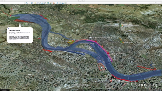
Dresden flood map

Flood defence 2.0
Using an electronic flood map helpers get flooding under control
When rivers burst their banks and dykes break, there is immanent danger. Professional and voluntary helpers have to get there quickly. The flood map of a private Dresden initiative aims to help prevent dangerous situations from arising during flood disasters by making important information visible and freely accessible. For instance, it gives helpers a quick overview of endangered dam sections, of roadblocks, and of sandbag filling stations. All of the data is available via smartphone or tablet PC at the location, facilitating communication between authorities and citizens.
Ausgezeichnete Orte 2013
Private Initiative/Sven Mildner
Briesnitzer Höhe 28
01157 Dresden
Sachsen

