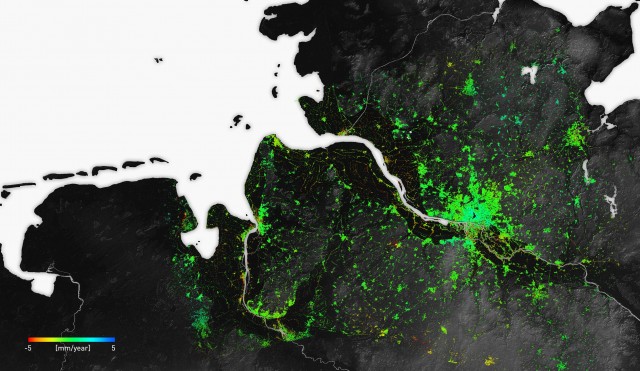
Satellite-guided ground movement map for Germany

On the ground of hard facts
A digital map shows movements on the surface of the earth down to the millimeter
When Earth is viewed from space, some problems seem insignificant. But this perspective also shows that even the tiniest shifts in the earth's surface can pose great dangers - for example, when they cause earthquakes. The German Aerospace Centre, the Technical University Munich, and the Institute for Geosciences and Natural Resources have developed a digital map that shows ground movements throughout Germany. State-of-the-art satellite technology measures where the earth's surface rises, sinks, or shifts down to the millimetre. This prevents buildings from being built on unsafe ground.
Ausgezeichnete Orte 2016
Deutsches Zentrum für Luft- und Raumfahrt, TU München, Bundesanstalt für Geowissenschaften und Rohstoffe
Münchner Str. 20
82230 Weßling
Bayern

